# figax = add_coastlines(plt.subplots(subplot_kw={'projection':proj,'transform':transf}))
# resolution = 7
# resolution = 12
resolution = 13
resolution0 = resolution
lat0 = np.array([ 0, 0, 1,1], dtype=np.double)
lon0 = np.array([ 0,1,1,0], dtype=np.double)
lats0,lons0,triang0,hull0 = make_hull(lat0,lon0,resolution0)
print('hull0: ',len(hull0))
idx = ps.from_latlon(np.array([1.25],dtype=np.double),np.array([1.25],dtype=np.double),10)
nbrs = ps.to_neighbors(idx)
latn,lonn,latcn,loncn = ps.to_vertices_latlon(idx)
lons1,lats1,intmat1 = triangulate1(latn,lonn)
triang1 = tri.Triangulation(lons1,lats1,intmat1)
lata,lona,latca,lonca = ps.to_vertices_latlon(nbrs)
lons2,lats2,intmat2 = triangulate1(lata,lona)
triang2 = tri.Triangulation(lons2,lats2,intmat2)
# idx1 = ps.from_latlon(np.array([1.5],dtype=np.double),np.array([0.5],dtype=np.double),10)
cover = ps.to_circular_cover(1.5,0.5,0.25,13)
latco,lonco,latcco,loncco = ps.to_vertices_latlon(cover)
lons3,lats3,intmat3 = triangulate1(latco,lonco)
triang3 = tri.Triangulation(lons3,lats3,intmat3)
# Set up the projection and transformation
# proj = ccrs.PlateCarree()
# proj = ccrs.Robinson()
# proj = ccrs.Geodesic()
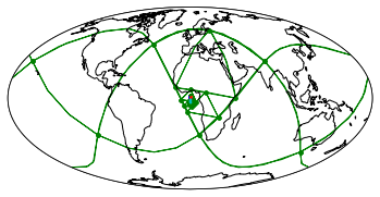
proj = ccrs.Mollweide()
transf = ccrs.Geodetic()
# transf = ccrs.PlateCarree()
plt.figure()
plt.subplot(projection=proj,transform=transf)
ax = plt.axes(projection=proj,transform=transf)
# ax.set_global()
ax.coastlines()
box_cover = ps.to_box_cover_from_latlon(np.array([-2,-2,-1,-1],dtype=np.double)
,np.array([-2,-1,-1,-2],dtype=np.double)
,10)
latco,lonco,latcco,loncco = ps.to_vertices_latlon(cover)
lons4,lats4,intmat4 = triangulate1(latco,lonco)
triang4 = tri.Triangulation(lons4,lats4,intmat4)
# resolution = 12
resolution = 13
flag5 = True
if flag5:
resolution5 = resolution;
# CCW
lat5 = np.array([ -1, -1.5, -1, -2, -2], dtype=np.double)[::-1]
lon5 = np.array([ 0,0.5,1,1,0], dtype=np.double)[::-1]
lats5,lons5,triang5,hull5 = make_nc_hull(lat5,lon5,resolution5)
# lats5,lons5,triang5,hull5 = make_hull(lat5,lon5,resolution5)
flag6 = True
if flag6:
resolution6 = resolution;
# CW
# lat6 = np.array([ -2-2, -2-2, -1-2, -1.5-2, -1-2], dtype=np.double)[::-1]
# lon6 = np.array([ 0,1,1,0.5,0], dtype=np.double)[::-1]
lat6 = np.array([ -1, -1.5, -1, -2, -2], dtype=np.double)-2
lon6 = np.array([ 0,0.5,1,1,0], dtype=np.double)
lats6,lons6,triang6,hull6 = make_nc_hull(lat6,lon6,resolution6,restrict=None)
# lats6,lons6,triang6,hull6 = make_nc_hull(lat6,lon6,resolution6,restrict=[100,101])
print('hull6: ',hex(hull6[0]))
# lats6a,lons6a,triang6a,hull6a = make_nc_hull(lat6[::-1],lon6[::-1],resolution6,restrict=[0,1001])
lats6a,lons6a,triang6a,hull6a = make_nc_hull(lat6[::-1],lon6[::-1],resolution6,restrict=None)
print('hull6a: ',hex(hull6a[0]))
# hull6 = np.array([0x3d2b61000000000a],dtype=np.int64)
plot1(lon0,lat0,lons0,lats0,triang0,c0='r',c1='b',transf=transf)
plot1(None,None,lons2,lats2,triang2,c0='r',c1='y',transf=transf)
plot1(None,None,lons1,lats1,triang1,c0='c',c1='r',transf=transf)
plot1(None,None,lons3,lats3,triang3,c0='c',c1='g',transf=transf)
plot1(None,None,lons4,lats4,triang4,c0='c',c1='g',transf=transf)
if flag5:
plot1(lon5,lat5,lons5,lats5,triang5,c0='c',c1='g',transf=transf)
plt.show()
# Set up the projection and transformation
# proj = ccrs.PlateCarree()
# proj = ccrs.Robinson()
# proj = ccrs.Geodesic()
proj = ccrs.Mollweide()
transf = ccrs.Geodetic()
# transf = ccrs.PlateCarree()
plt.figure()
plt.subplot(projection=proj,transform=transf)
ax = plt.axes(projection=proj,transform=transf)
ax.set_global()
ax.coastlines()
plot1(lon0,lat0,lons0,lats0,triang0,c0='r',c1='b',transf=transf)
plot1(None,None,lons2,lats2,triang2,c0='r',c1='y',transf=transf)
plot1(None,None,lons1,lats1,triang1,c0='c',c1='r',transf=transf)
plot1(None,None,lons3,lats3,triang3,c0='c',c1='g',transf=transf)
plot1(None,None,lons4,lats4,triang4,c0='c',c1='g',transf=transf)
if flag5:
plot1(lon5,lat5,lons5,lats5,triang5,c0='c',c1='g',transf=transf)
if flag6:
plot1(lon6,lat6,lons6,lats6,triang6,c0='c',c1='g',transf=transf)
# plot1(None,None,lons6a,lats6a,triang6a,c0='y',c1='c',transf=transf)
# plot1(lon6,lat6,lons6a,lats6a,triang6a,c0='y',c1='c',transf=transf)
# plot2([0x3d2b61000000000b],c1='r',transf=transf)
# plot2([0x3d2b61200000000b],c1='g',transf=transf)
# plot2([0x3d2b61400000000b],c1='b',transf=transf)
# plot2([0x3d2b61600000000b],c1='k',transf=transf)
# plot2([0x3d2b61400000000c],c1='r',transf=transf)
# plot2([0x3d2b61480000000c],c1='g',transf=transf)
# plot2([0x3d2b61500000000c],c1='b',transf=transf)
# plot2([0x3d2b61580000000c],c1='k',transf=transf)
if False:
plot2([0x3d2b61400000000d],c1='r',transf=transf)
plot2([0x3d2b61420000000d],c1='g',transf=transf)
plot2([0x3d2b61440000000d],c1='b',transf=transf)
plot2([0x3d2b61460000000d],c1='k',transf=transf)
plt.scatter(0.9474437025372493,-2.9981275066380708,s=10,c='c',transform=ccrs.PlateCarree())
test_trixels = [0x3d2b61400000000d,0x3d2b61420000000d,0x3d2b61440000000d,0x3d2b61460000000d]
level_zero_increment = ps.spatial_increment_from_level(0)
sivs = [ siv for siv in range(0,8*level_zero_increment,level_zero_increment) ]
print("Spatial ID",hex(sivs[7]))
plot2([sivs[7]],transf=transf)
plt.show()